


A groundbreaking collaboration between NASA and the small business Aloft Sensing has led to the development of a compact radar system that promises to transform the way researchers observe dynamic Earth systems. This innovative radar, designed for use on High Altitude Long Endurance (HALE) platforms, offers highly sensitive measurements without the need for GPS positioning. The implications of this technology extend beyond Earth, with potential applications on vehicles in space.
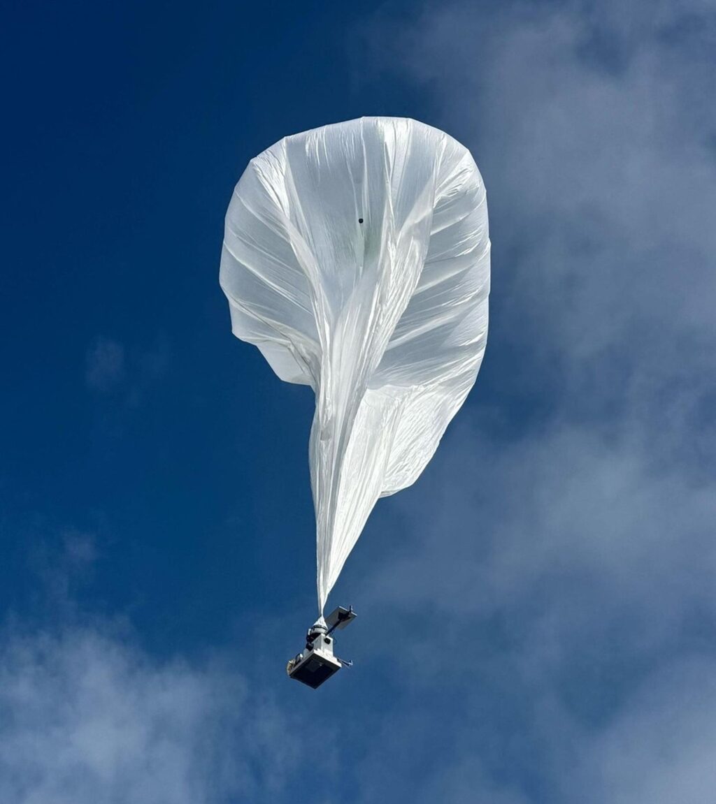
The new radar, known as HALE InSAR, recently underwent a successful test flight aboard a high-altitude balloon. This lightweight instrument is poised to assist researchers in measuring ground deformation and other dynamic Earth systems with unprecedented precision. According to Aloft Sensing, the radar’s ability to detect millimeter-scale changes in the Earth’s surface could serve as an early warning system for natural disasters.
Revolutionizing Earth Observation
Supported by NASA’s Earth Science Technology Office (ESTO), Aloft Sensing’s HALE InSAR project aims to provide detailed observations of Earth’s surface deformation, topography, and vegetation. The project has demonstrated the feasibility of using HALE vehicles equipped with Interferometric Synthetic Aperture Radar (InSAR) to observe minute changes in surface deformation and terrain information with centimetric vertical accuracy.
“It’s a level of sensitivity that has eluded traditional radar sensors, without making them bulky and expensive,” said Lauren Wye, CEO of Aloft Sensing and principal investigator for HALE InSAR.
HALE vehicles are specially designed lightweight aircraft capable of remaining airborne for extended periods, ranging from weeks to years. These vehicles can revisit the same location multiple times an hour, making them ideal for detecting subtle geological changes.
Innovative Design and Technology
Traditional InSAR instruments are typically too large for HALE vehicles. However, HALE InSAR is different. Weighing less than 15 pounds (seven kilograms) and consuming fewer than 300 watts of power, it is compact enough for various HALE platforms. This is achieved through a combination of advanced technologies, including a novel electronically steered antenna and sophisticated positioning algorithms embedded within an agile software-defined transceiver.
“All of the design features that we’ve built into the instrument are starting to showcase themselves and highlight why this payload in particular is distinct from what other small radars might be looking to achieve,” said Wye.
A key feature of HALE InSAR is its flat phased array antenna, which allows users to focus the radar beam without physically moving the instrument. This eliminates the need for heavy components, enabling the instrument’s reduced size and weight.
Advanced Positioning and Applications
One of the standout features of HALE InSAR is its ability to navigate without GPS. By relying on feedback from its own radar signals, the instrument can determine its position with greater accuracy. This capability is particularly useful in environments where reliable GPS signals may be unavailable, such as remote locations or national security applications.
“SAR is like a long exposure camera, except with radio waves. Your exposure time could be a minute or two long, so you can imagine how much smearing goes on if you don’t know exactly where the radar is,” explained Brian Pollard, Chief Engineer at Aloft Sensing and co-investigator for HALE InSAR.
The Aloft Sensing team has already achieved several key milestones, validating their instrument aboard an airship at 65,000 feet and on small stratospheric balloons. The next phase involves testing HALE InSAR aboard a fixed-wing HALE aircraft, with future plans to deploy the technology in low Earth orbit on a small satellite.
Future Prospects and Impact
NASA’s support has been instrumental in transforming HALE InSAR from a prototype into a proven instrument. The technology exemplifies the dual-use potential enabled by NASA-funded research, with significant interest from military sectors as the capability reaches maturity.
“This technology has been critically enabled by ESTO, and the benefit to science and civil applications is huge,” said Wye. “As a small business, we need this hand-in-hand approach to be able to succeed.”
As HALE InSAR continues to evolve, its ability to provide high-resolution data on Earth’s surface changes holds promise for a wide range of applications, from disaster preparedness to environmental monitoring. The collaboration between NASA and Aloft Sensing represents a significant step forward in the field of Earth observation technology.