


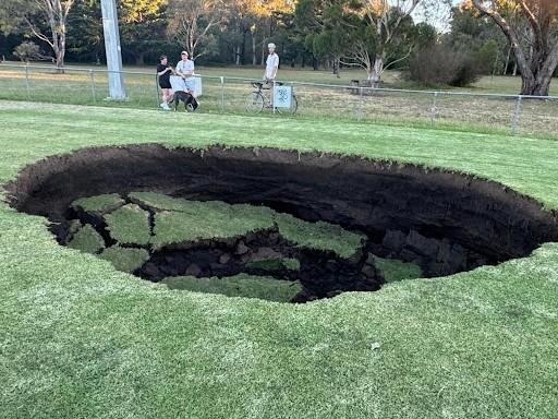
More than 60,000 properties across Melbourne’s inner-northern suburbs have been identified as flood-prone in new modelling released alongside a statewide risk rating system. The system aims to assign a threat level to each home, with significant implications for residents and developers alike.
Approximately 38,580 properties in the Darebin Council area, which includes suburbs such as Northcote, Preston, and Reservoir, and another 21,620 premises in the Yarra Council area, encompassing Fitzroy, Richmond, and Clifton Hill, are at risk if severe inundation occurs this year. Previously, fewer than 10,000 properties in each of these council areas were deemed flood-prone.
New Flood Risk Rating System
The Allan government, in collaboration with Melbourne Water, is introducing a new risk-based flood rating system. This initiative mirrors the approach used in bushfire-prone areas since 2015 and will be implemented across Victoria as further flood models are updated. The system categorizes properties into six risk levels, with about 80% of at-risk properties in Darebin and Yarra falling into the lowest two categories, meaning water could reach depths of up to 50 centimeters.
Chris Brace, Melbourne Water’s executive general manager of service futures, explained that the hazard rating system is designed to simplify information for residents and inform emergency services and government planning controls. “Historically, flood management in Melbourne has focused on waterway flooding, but as we see climate change and rainfall intensity change, the risk of stormwater flooding is increasing,” Brace said.
Impact on Insurance and Property Values
Until now, flood modelling was used to determine which properties would be subject to a blanket inundation overlay, regardless of their level of flood risk. This often led to increased insurance costs, decreased house values, and stringent building restrictions. The new rating system will classify affected properties in Darebin and Yarra under new low-risk or high-risk flood zone controls.
Interactive maps will be available on Melbourne Water’s website from Friday morning, allowing residents to enter their address and receive their risk rating. Currently, only stormwater flood maps are available, with creek and river flooding maps expected in the coming years.
Government and Community Reactions
Water Minister Gayle Tierney stated, “This is about protecting lives and property where the risk is greatest, while making it easier to build homes and businesses in low-risk places.” The reforms aim to reduce obstacles hindering the Victorian government’s goal of constructing 800,000 new homes by 2034.
Planning Minister Sonya Kilkenny added, “We’re providing better information and more clarity to councils, industry, and communities, so we can manage flood risks while building the homes that Victoria needs.”
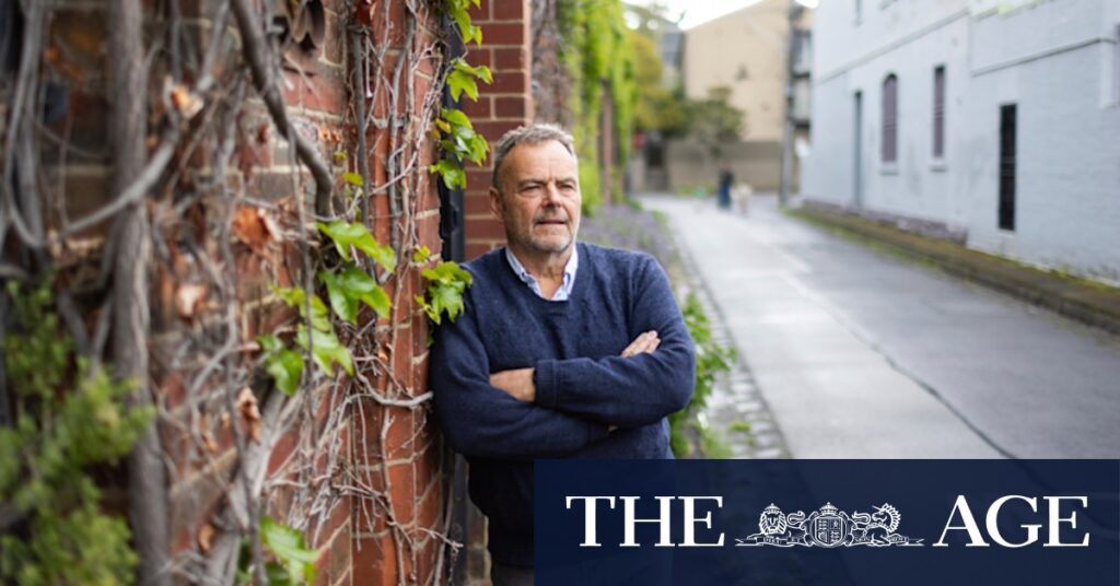
However, some community members express concerns. Fitzroy Residents Association chair Michael Spencer, who researches climate change adaptation at Monash University, criticized the release of new flood maps without a clear strategy for addressing the issues, such as measures for slowing and capturing floodwaters. “Otherwise, the only solution is going to be that the cost of this changed risk is borne by households and businesses,” Spencer said.
Historical Context and Future Plans
Melbourne Water updated its flood maps for the Maribyrnong River catchment last year, prioritizing it after the inundation disaster of 2022. However, these maps will not be reviewed until 2029 at the earliest. Maribyrnong Catchment Resilience Association president Madeleine Serle expressed disappointment that the new risk-rating model would not be applied to the Maribyrnong River for several years.
Serle warned that the new system would be of little value without insurance reform and significant government investment in emergency management and mitigation strategies. “Communities have to have a reasonable pathway forward to become resilient, but they are the least powerful to do this,” she said.
A spokeswoman for the Insurance Council of Australia noted that the release of new flood modelling is unlikely to provide new details to insurers, who already use their own information and modelling to assess flood risk. “The insurance industry has long advocated for greater public investment in risk reduction and climate risk mitigation to safeguard people’s assets and protect communities,” she said.
The Victorian government asserts that the new hazard-rating system will guide funding decisions for emergency services and mitigation efforts. Melbourne Water has spent about $170 million on drainage management and mitigation over the past five years and proposes increasing the investment to $300 million for the next five years.
Brace emphasized that Melbourne Water has learned from previous floods. Residents in Darebin and Yarra are receiving letters and can access detailed maps, explainer videos, online guides, and community sessions. Those at high risk of flooding will be contacted directly.
Melbourne Water plans to renew flood modelling for every municipality in the city over the next two years, with Glen Eira and Merri-bek councils next in line.