


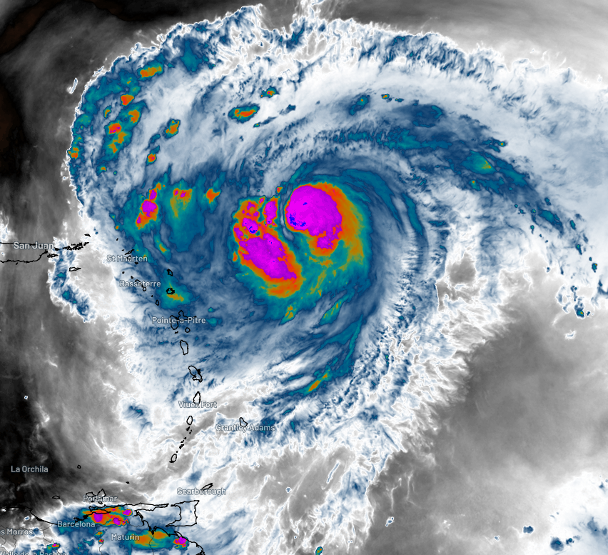
Hurricane Erin, positioned east of the eastern Caribbean islands, has been gradually strengthening over the past few days as it moves westward through the tropical North Atlantic Ocean. It has now become the first hurricane of the 2025 North Atlantic season.
According to the National Hurricane Center (NHC), as of Friday afternoon local time, Erin has recorded maximum sustained winds of 65 knots (approximately 120 km/h). This wind speed surpasses the threshold required to classify as a Category 1 hurricane and is equivalent to a Category 3 tropical cyclone in Australian and South Pacific waters.
The emergence of Hurricane Erin coincides with the onset of the peak hurricane season in the North Atlantic, which typically sees 4-5 hurricanes form between August and October, alongside 8-10 named tropical storms during the same period.
Early Impacts and Current Threats
Initially, as a tropical disturbance, Erin caused significant flooding in Cabo Verde, an island nation located just west of Africa. Now, Erin poses a threat to several eastern Caribbean nations with the potential for damaging winds, heavy rainfall, and dangerous surf conditions. The NHC forecasts up to 150 mm of rainfall and a 10-30% chance of tropical storm-force winds (exceeding 34 knots or 63 km/h) for the islands in this region by Sunday morning local time.
In the coming days, Erin is expected to intensify rapidly, potentially becoming a major hurricane by Saturday night local time. Fortunately, it is predicted to curve away from the Caribbean, which will be a relief for residents and tourists. Nevertheless, some impacts are still anticipated for the northern and eastern coasts of islands such as Puerto Rico and the Bahamas, and later in the week for Bermuda.
Potential Impact on the U.S. Mainland
As for the mainland United States, Hurricane Erin is projected to track roughly parallel to the coast, making direct impacts unlikely. However, the storm is expected to generate very large and potentially damaging surf along the exposed Atlantic coast, particularly in North Carolina, where waves could reach up to 16 feet (5 meters) by the middle of next week.
Image: MetStorm estimated accumulated rainfall for 120 hours across the Atlantic Ocean. Higher accumulations across the center of the image are associated with Hurricane Erin as it developed. Source – Weatherzone
Historical Context and Future Outlook
The formation of Hurricane Erin as the first hurricane of the season is a reminder of the increasing frequency and intensity of tropical storms and hurricanes in the North Atlantic. This trend has been attributed to rising sea temperatures and climate change. Historically, the peak of the hurricane season has been a period of heightened vigilance for residents in hurricane-prone areas.
Experts emphasize the importance of preparedness and staying informed through reliable sources such as the NHC. As Erin continues to develop, monitoring its trajectory and potential impacts will be crucial for those in its path.
For continuous updates on Hurricane Erin, the National Hurricane Center’s website remains a valuable resource for the latest information and advisories.
Image: DTN 1FX significant wave height forecast for Wednesday night local time. Source – Weatherzone
As the hurricane season progresses, the development of Erin serves as a stark reminder of the power and unpredictability of nature, underscoring the need for ongoing research, preparedness, and adaptation strategies in the face of a changing climate.