


NASA announced last week that the University of Washington’s STRIVE team and the UW-affiliated EDGE team have been selected to lead groundbreaking satellite missions. These missions aim to enhance our understanding of Earth and improve our ability to predict environmental events and mitigate disasters.
Both STRIVE and EDGE were among four finalists chosen in May 2024 as part of NASA’s Earth System Explorers Program. This initiative conducts principal investigator-led space science missions, aligning with recommendations from the National Academies of Sciences, Engineering, and Medicine’s 2017 Decadal Survey for Earth Science and Applications from Space. According to NASA, the total estimated cost of each mission, excluding launch, will not exceed $355 million, with a launch date set for no earlier than 2030.
STRIVE: A Leap in Atmospheric Observation
The STRIVE mission, short for Stratosphere-Troposphere Response using Infrared Vertically-resolved light Explorer, will explore the atmospheric regions where weather forms and the ozone layer resides. This mission promises to yield new insights into atmospheric temperature and trace gases that impact aviation and the long-range transport of volcanic smoke and air pollution.
Lyatt Jaeglé, a UW professor of atmospheric and climate science leading the STRIVE mission, expressed enthusiasm about the project. “This was fantastic news. We have been working on this concept for a few years now, and for many of us, it is a dream come true. To be able to observe the atmosphere at this level of detail is a tremendous opportunity,” Jaeglé stated.
“With these observations, we won’t just get measurements of ozone but rather all the chemical species that affect ozone in the stratosphere,” Jaeglé added.
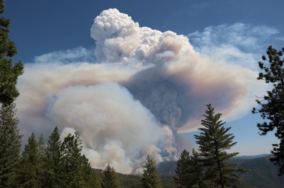
The STRIVE instruments, designed to fit into the trunk of a midsize SUV, can make over 400,000 observations daily. Unlike traditional missions that look straight down, STRIVE’s instruments angle sideways towards Earth’s surface, capturing the atmosphere in greater detail. This approach will help researchers understand how air pollution circulates following events like wildfires or volcanic eruptions and improve weather forecasting beyond the typical 10-day window.
The national-scale team includes partners from academia, industry, and federal science labs. Jun Wang at the University of Iowa serves as the deputy principal investigator, and Luke Oman at NASA’s Goddard Space Flight Center is the project scientist. Other UW members include professor Qiang Fu, assistant professor Alex Turner, and affiliate faculty member Daehyun Kim, all from the UW Department of Atmospheric and Climate Science.
EDGE: Mapping Earth’s Dynamic Surface
The EDGE mission, or Earth Dynamics Geodetic Explorer, aims to observe the three-dimensional structure of Earth’s surface, including forests, glaciers, ice sheets, and sea ice. Led by Helen Amanda Fricker from the Scripps Institution of Oceanography at the University of California San Diego, the EDGE team includes Benjamin Smith, a senior principal physicist, and Tyler Sutterley, a senior research scientist, both from the UW Applied Physics Laboratory, along with David Shean, a UW associate professor of civil and environmental engineering.
According to a UCSD press release, EDGE will be the first global satellite imaging laser altimeter system. The system captures surface detail in high resolution by firing laser pulses at the Earth and recording their return time, making over 150,000 measurements each second. This capability allows precise tracking of changes in surface elevation over time, crucial for understanding how ice sheets and glaciers respond to climate change over various timescales.
“What’s really exciting about EDGE is the level of detail it will measure. Older laser altimetry measurements sample a coarse grid of points on the ground, but with the EDGE data, we will be able to see individual trees around Seattle and small cracks in glaciers in Greenland and Antarctica,” Smith explained.
While EDGE will focus on polar regions, forests, and coastlines, it is described as an “everything mission,” according to Shean. “These precise surface elevation change measurements are essential for so many pressing scientific and engineering applications,” he noted. “The EDGE data will have implications for sea level rise, natural hazards monitoring, water resource and forest management, and wildfire response.”
Implications and Future Prospects
The selection of these missions marks a significant milestone for the University of Washington, formalizing its leadership and involvement in not one, but two NASA Earth Observation missions. “I’m excited to bring students onto the EDGE team and train the next generation of UW researchers who will do amazing things with EDGE data in the coming decades,” Shean added.
This development underscores NASA’s commitment to advancing Earth science and highlights the critical role of academic institutions in pioneering space exploration and environmental monitoring. As these missions progress, they hold the promise of transforming our understanding of atmospheric and surface dynamics, with far-reaching implications for science, policy, and global environmental management.