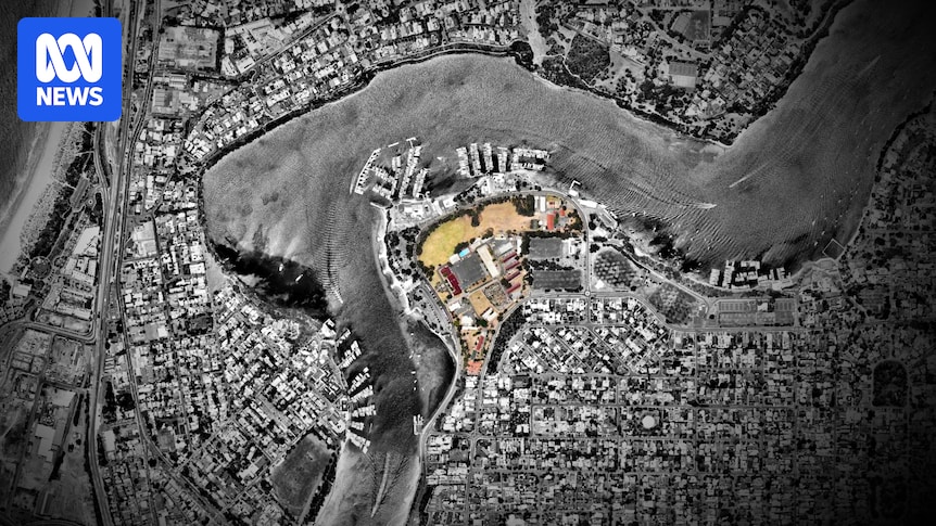


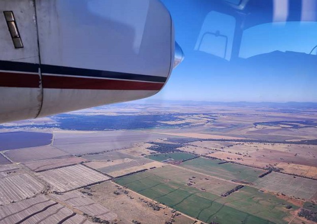
Researchers in Australia have made significant strides in koala conservation through the innovative use of airborne hyperspectral imaging. This cutting-edge technology has been deployed to map the distribution of eucalyptus trees preferred by koalas, a critical step in preserving their dwindling habitats. Dubbed ‘Project Airbear,’ this initiative involves scientists using a sophisticated hyperspectral imager mounted on a light aircraft to survey fields and forests near Gunnedah, New South Wales.
The technology, which utilizes narrowband visible and infrared light, is capable of detecting subtle characteristics within trees, such as leaf pigment, water content, and crucially, nitrogen content. Koalas are notoriously selective eaters, favoring leaves from specific types of eucalyptus trees that meet their nutritional needs, particularly those with appropriate nitrogen levels. With habitat loss being a major factor in the decline of koala populations, identifying and preserving these food sources is vital.
Understanding Koala Dietary Preferences
“It’s a real ‘Goldilocks’ situation when looking for the best locations for koala habitats,” said Professor Mathew Crowther, the research lead from the School of Life and Environmental Sciences at the University of Sydney. “It’s not just about finding the right tree species; it also needs to have the right nutritional quality that can help a population to thrive long term. That can even differ within the same tree species.”
Professor Crowther emphasized the novelty of this approach, stating, “To our knowledge, no koala-focused study has attempted to classify individual eucalyptus species using this method and include tree species as a candidate to improve nitrogen content predictions.” The promise of this technology lies in its potential to expedite the identification and protection of invaluable habitats.
Remote Sensing: A Comparative Analysis
According to a study published in Science of the Total Environment, various remote sensing techniques have been explored to study koala habitats and the vegetation they require. These methods include analyzing vegetation productivity in relation to koala presence, monitoring habitat health, and assessing bushfire damage impacts.
Remote sensing using UAVs provides fine spectral and spatial resolution but is limited to small areas. Conversely, satellite imagery covers larger areas but with less precision. “At this moment in time, airborne hyperspectral data lies in between these two extremes, offering a balance between spectral resolution and spatial extent, and is thus well-suited for regional-scale ecological application,” the authors noted.
“Compared to satellite multispectral sensors, airborne hyperspectral instruments provide hundreds of ‘contiguous’ narrow spectral bands, enabling detection of subtle spectral differences critical for predicting foliar chemistry and distinguishing closely related species.”
Technical Insights and Collaborations
The study was a collaborative effort between the University of Sydney, the Sydney Institute of Agriculture, the University of New England, and HyVista Corporation. HyVista utilized a HyMap hyperspectral scanner, manufactured by Integrated Spectronics, to conduct the research.
- The HyMap scanner features 128 bands across the reflective solar wavelength region of 0.45 – 2.5 um with contiguous spectral coverage, except in the atmospheric water vapor bands, with an average bandwidth of 15nm.
- It includes a 3-axis gyro-stabilized platform to minimize distortion due to motion.
- The scanner is spectrally and radiometrically calibrated using NIST traceable sources, producing low-noise ‘analysis ready’ imagery.
The research underscores the potential of hyperspectral airborne imagery for koala conservation by identifying high-quality koala habitats. The authors highlighted the value of ‘pixel-based’ datasets in training models to predict tree features, despite potential noise and diversity in the data.
Future Directions in Conservation
“Robust remote sensing techniques that identify the species composition down to individual plants across landscapes are a big step forward for Australian ecology and Earth observation,” said Professor Bradley Evans from the University of New England. “With the spectral and spatial power of the HyVista HyMap sensor, we can cover an order of magnitude more ground per day flying faster than with our drones.”
Looking ahead, the next stage of the research will involve NASA JPL using its latest hyperspectral imager next year. “We will be working with various environmental and agricultural agencies to have NASA and HyVista fly our most critical sites,” Professor Evans stated.
The University of New England, in partnership with the University of Sydney and others, is also planning a new ‘National Collaborative Facility’ for this technology. This initiative aims to leverage the technology for Australia and foster future collaborations with NASA, marking a significant advancement in ecological research and conservation efforts.