


In a groundbreaking effort to enhance flood management in one of Australia’s most flood-prone regions, the Commonwealth Scientific and Industrial Research Organisation (CSIRO) has developed a highly detailed virtual model of the Richmond River catchment in northern New South Wales. This innovative model is designed to evaluate the most effective flood mitigation strategies, offering a new level of precision and insight into flood behavior.
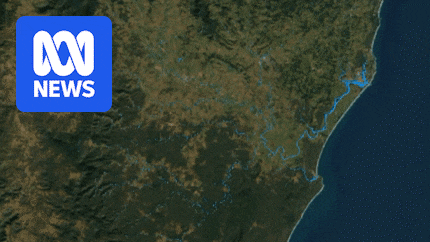
The Richmond River catchment, spanning 7,000 square kilometers, has been mapped with unprecedented detail, incorporating millions of data inputs. These include critical flood-related factors such as topography, hydrology, evaporation, soil types, and vegetation. According to Dr. Jai Vaze, a senior principal research scientist leading the project, this detailed mathematical representation is essential for reliable flood-mitigation scenario testing.
“To look at any flood-mitigation scenarios reliably, whether it will work or not, you need a catchment-scale model,” Dr. Vaze stated. “The report has been reviewed by three international independent experts and one of them has said, effectively this will be used as a template for any future large flood studies.”
Unveiling the Model’s Mechanics
The model demonstrates how flooding unfolded over a six-week period in 2022, leveraging Bureau of Meteorology rainfall data refined to hourly readings localized to one-square-kilometer grids. This precision is the culmination of over two years of meticulous work by Dr. Vaze and his team. Advanced technologies such as sonar and Lidar were employed to gather high-resolution data on river depths and topography across the Tweed, Brunswick, Richmond, and Clarence river catchments.
Sonar was instrumental in creating bathymetric maps of flood-prone rivers, while Lidar technology, with its 3D laser scanning capabilities, collected 16 measurement points per square meter across 30,000 square kilometers. This comprehensive data collection is crucial for testing various flood mitigation options, including infrastructure like levees.
Testing Flood Defenses
The model’s capacity to simulate and test the impact of different flood mitigation strategies marks a significant shift from reactive to proactive flood management. Dr. Vaze emphasized that the project aims to move beyond immediate flood responses to strategic planning that mitigates future impacts.
The 2022 Northern Rivers floods have already cost the NSW and federal governments $880 million in reactive measures, such as relocating people off flood plains or retrofitting homes. An additional $150 million has been allocated for resilience measures, including upgrades to pumping stations and flood channels, community-led resilience teams, and reforestation projects.
Landcare received more than $5 million to improve river health, including planting 30,000 trees.
Community Involvement and Expectations
The Lismore Citizens Flood Review Group, active since the Cyclone Debbie flood of 2017, has been a key collaborator in integrating local knowledge into the model. Beth Trevan and her son Richard have been vocal advocates for the project, acknowledging the serendipitous support from the National Recovery and Resilience Agency.
“He [Dr. Vaze] is totally committed to the region and solving the problem,” Mrs. Trevan remarked. “What is being developed is international best practice; it’s not only going to be a template for Australia, it’s going to be a template internationally.”
Richard Trevan highlighted the critical nature of the model’s success in developing effective flood-mitigation solutions for the Richmond River catchment, noting the disproportionate allocation of government funding towards recovery rather than mitigation.
“Nationally, just 3 per cent of government funding has gone into mitigation while 97 per cent is spent on recovery,” he pointed out. “Lismore has one chance to get this right.”
Challenges and Skepticism
Despite the optimism surrounding the model, some local residents remain skeptical about its potential impact. Whian Whian resident Patrick Tatam, who has been monitoring rainfall data for over a decade, expressed doubts about the feasibility of mitigating the powerful water flows experienced during heavy rains.
“Having seen the strength of the water as it comes down this creek, I’d suggest there is very little that is going to impede that flow,” Mr. Tatam said. “It is strong and violent.”
As the CSIRO’s model continues to evolve, it represents a significant step forward in flood management, with the potential to inform not only local but also international flood mitigation efforts. The project underscores the importance of integrating scientific innovation with community insights to address complex environmental challenges.